Research Interests
I am trained as a watershed hydrologist and broadly study how water and solutes are transported through the environment. I am particularly interested in how hydrologic connectivity between landscapes and their streams and aquifers controls the transport and fate of water and solutes, and the ecological implications of these fluxes. My main approach for research is to use a combination of field experimentation and numerical modeling to develop a mechanistic understanding of processes that can be validated by observations.
Current Projects
|
Effects of human modification to landscapes for agricultural purposes on water stores and fluxes and implications for nutrient transport
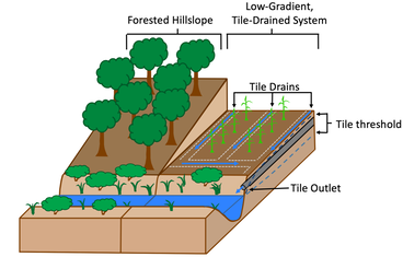
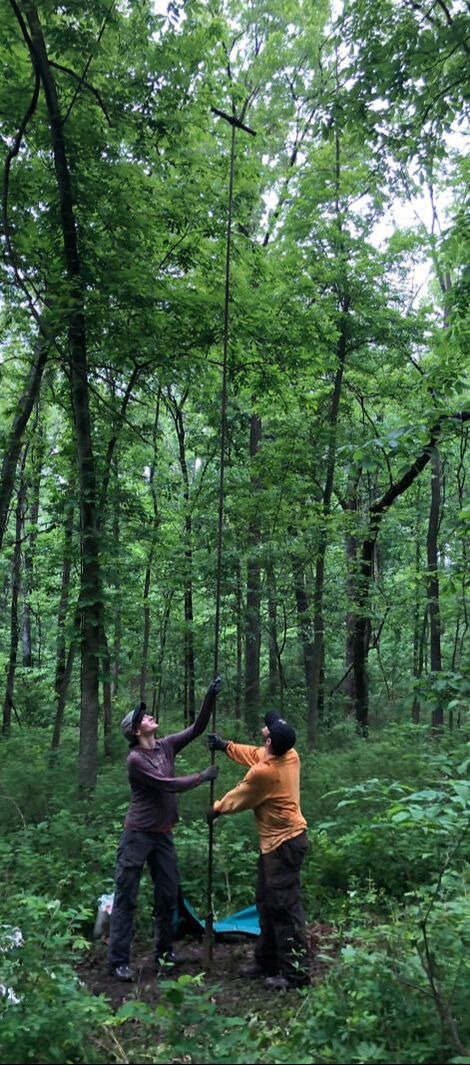
Midwestern U.S. row crop farming In the Midwestern U.S., spatially-extensive modification of the drainage network for agriculture has resulted in alteration of the natural hydrologic cycle. Artificial drainage systems, installed to maintain optimal growing conditions for crops, have increased hydrologic connectivity between landscapes and streams by providing a mechanism for infiltrating water to bypass deeper groundwater. For this project, I use empirical data from a farm field located in the Sangamon River Basin, Illinois as the primary motivation for the study. A coupled surface-subsurface flow model and soil-vegetation-atmosphere interaction model is used to investigate how the interaction of artificial drainage (“tile drains’”) with antecedent wetness conditions controls threshold changes in tile drain storm runoff responses. Furthermore, I link these hydrologic dynamics to observed biogeochemical responses (e.g., nitrogen export). The ability to link subsurface runoff response patterns to runoff generation mechanisms will improve our understanding of water and nutrient transport in human-modified agricultural catchments and inform land management decisions aimed to address nonpoint source pollution in the Midwestern U.S. This project is funded through the Intensively Managed Landscapes Critical Zone Observatory. Madagascar rice paddies
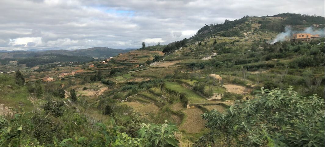
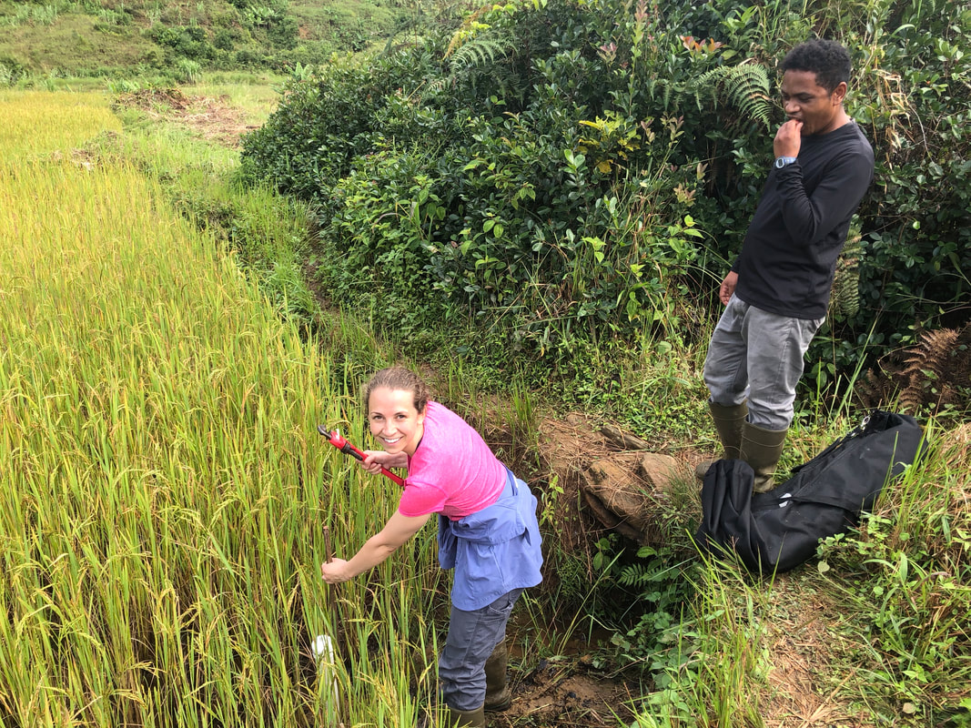
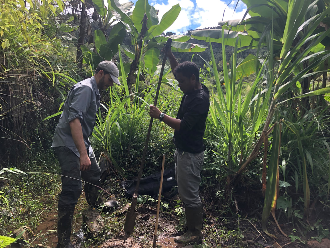
As the most rapidly growing food source in Africa, rice is central to national security plans of many African governments, and expansion and intensification of rice cultivation is expected to continue in order to support increasing populations. Tightly coupled with food security risks is water insecurity. In addition to a greater water demand from agricultural intensification, increased variability of rainfall associated with climate change may necessitate more farmers to irrigate to maintain productivity. Furthermore, increased application of industrial fertilizers and pesticides under agricultural intensification could threaten water quality. The objective of this research is to advance our understanding of how rice fields impact basin-level water stores, fluxes, and residence times, and how this activity alters the transport and fate of nutrients. In particular, we consider how the conversion of headwater mountain streams to terraced hillslope rice paddies alter hydrologic flow paths and nutrient processing. We use monitoring data from a research site in Madagascar, a country with a long history of rice cultivation, to motivate the study. A hydrologic model is used to simulate flow paths and residence times. Research facilities are provided by the Centre Valbio Research Station. Travel was supported by a an IU Global Pre-Dissertation Grant. |
|
Role of floodplains in river corridor exchange
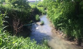
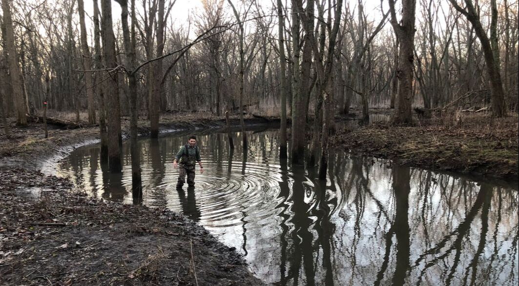
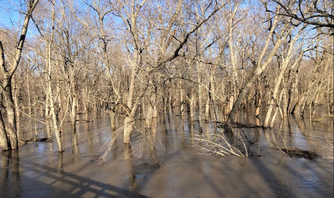
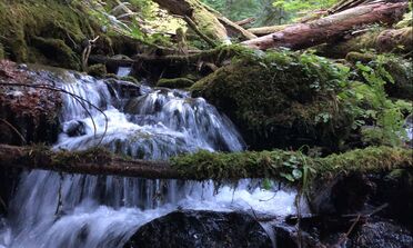
At the reach-scale, hydrologic connectivity between rivers and their floodplains is often simplified to a binary state of connected (flooded) or disconnected (dry). In this study, I use a combination of field and modeling techniques to consider the continuum of connectivity induced by ephemerally-inundated floodplain channels to better understand their hydrologic and biogeochemical functioning in low-gradient, alluvial floodplain systems. Typically dry, floodplain channels activate prior to river water overtopping all banks, thereby enhancing hydrologic connectivity between rivers and their floodplains for moderately high flows. The goal of this study is to investigate how dynamic hydrologic forcing and floodplain topography interact to control river corridor exchange, with a focus on hyporheic exchange fluxes, and the mechanisms by which floodplains inundate and drain. Ultimately, I plan to relate changes in subsurface residence time distributions to biogeochemical timescales in order to compare the biogeochemical potential of floodplain channels to other features (river bank exchange, bedforms, meanders). Underpinning the importance of the analysis is the large-scale removal of these floodplain features via conversion of floodplain ecosystems to row crops in the agricultural Midwest. This project is funded through the Intensively Managed Landscapes Critical Zone Observatory. |
|
|
|
Influence of transport process representation in models on interpretations of water and solute stores and fluxes
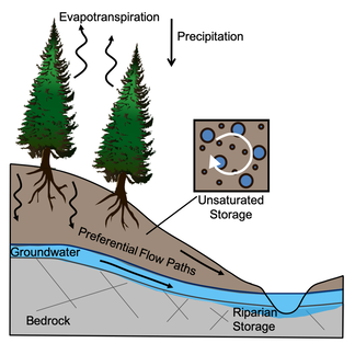
The dynamic connection and disconnection of water storages in landscapes is a key control on water and solute transport. Hydrologic connectivity occurs at a range of scales, aggregating to landscape-scale effects for run-off generation and biogeochemistry. In this study, I investigate how representing moisture-dependent, pore-scale hydrologic connectivity in a catchment-scale hydrologic model alters interpretations of stores, fluxes, and residence times of water. Recent studies have demonstrated that compartmentalized pools of water preferentially supply either plant transpiration (poorly mobile water) or streamflow and groundwater (highly mobile water) in some catchments, a phenomenon referred to as ecohydrologic separation. The omission of processes accounting for ecohydrologic separation in hydrological models influence estimates of water residence times and plant water availability. To quantify these differences, I develop two lumped rainfall-runoff models that integrate catchment-scale representations of transport, one which incorporates mechanisms consistent with ecohydrologic separation and one which does not and is similar to conceptual models used in most studies. I use simple estimates to relate differences in internal catchment functioning to timescales for nitrification and the availability of water for vegetation, demonstrating the relevance these changes to conceptual hydrologic models have on ecological processes. This study is a first step in investigating how our evolving conceptual model results in changes to our interpretation of the storage and transport of water and solutes at the catchment scale. This project was supported by a Fulbright Research Fellowship in Water Management and data and facilities were provided by the H.J. Andrews Experimental Forest. |
